Tuesday, October 23, 2007

19. Blueberries & Brotherly Love

(27 June)
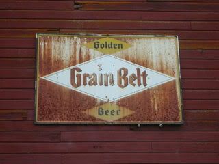
On Wednesday, neither of us felt like canoeing, although we had discussed a Vermilion River adventure. Sometime the day before, while passing through Buyck, we had stopped at the river to check out the water access. There, across the road from the VRT (Vermilion River Tavern), was a shabby golf course, on which stood an old barn where they kept the golf carts. On its north side, facing the river, hung an ancient Grain Belt sign, at least as old as the sacred bottlecap sign on the Mississippi in downtown Minneapolis. This sign was streaked with a gorgeous patina of rust.


Today, our first order of business was to call my mom to let her know we were definitely coming home the next day. My dad didn't want to drive to Orr again, because we had made the twenty mile drive every day we had been there. We got on the road and watched our phones for a signal. Funny enough, we got absolutely nothing until we reached the city limits of Orr. My dad made the call while I heeded nature's call inside the gas station.

We then parked in front of the on/off-sale liquor store/tavern to take care our second order of business: buying beer. I think we had about ten cans left for our last night, but when my dad had opened the cooler that morning, he became worried.

Since I had forgotten my ID, I stayed in the car, just to make it easier. My dad entered the building, and soon afterward, a man stepped out of a large black pickup next to me. He had a big, blond, Hogan mustache, and a long, greasy, curly mullet. He was quite a specimen of man, and he, too, entered the tavern.

While they were inside, I checked my messages from the past few days. There was a message from my friend Sho, who said that he and my other Rambo-watching buds had been playing music together, and were trying to book a show. Their name: Rambro!

My dad came out of the shop empty-handed. The other man also came out, they exchanged words, and my dad got in the car. He shook his head in disbelief. "You won't believe what just happened," he said. "So their computer was down. And the girl working was really stupid. I had my twelve-pack of Miller High Life up at the counter, and she said we can't make the exchange!"

"You couldn't just just give her the cash, and she'd ring it up later?" I asked.

"I guess not!" He sighed loudly. "So I turned around and was putting the beer back in the cooler, when that guy walked in. He must have thought my card didn't go through or something. And immediately, he said, 'Bring that back up here. I'll pay for it.'"

"Whoa!" I exclaimed.

"And at first, I brought it back. I thought maybe he was a local, and he knew how to handle these things. But when he found out the situation, even he couldn't do anything."

My dad was visibly touched by the man's kindness. The guy hadn't hesitated one instant, probably because he'd been on the opposite side of that situation before. He would not let my dad go without beer. What a man!

After getting our beer at the Sportsman's Last Chance in Buyck, we wanted to take a long hike, and decided to start in our campground at the Echo Lake Trail. It headed east from the main loop, beginning right next to the self-registration station.

We walked a ways through the woods, and the trail opened up onto a rocky outcropping with jack pines and a few blueberry plants with ripe berries. We enjoyed some while we paused to enjoy the spot. Continuing on, the trail led through the woods and onto more outcroppings. On these, the trail, worn into the soil in the woods, was invisible, but was marked by cairns someone had piled.

It was another beautiful, sunny day. Eventually, we emerged from the woods a final time, onto a huge expanse of rock and jack pines, from which a murder of crows took off. The rock face overlooked an immense valley of birch trees. And all around us grew ripe blueberries! I told my dad I wanted to go back to camp to get a tupperware to fill up, since blueberries are like seven dollars a pound in the store, and here they were, freely growing. He offered his quart-sized nalgene bottle to fill up, and this we began doing with determination.

A big handful contained about fifty of these smallish berries. We moved forward as we harvested, leaving countless missed berries, plus the underripe ones on each plant. Someone could do this again in a few days.

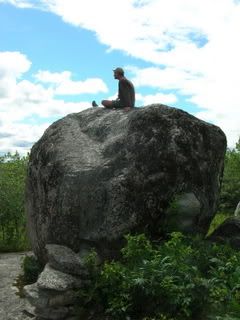
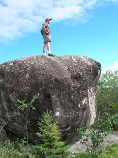
As we neared the top of a hill, we saw a giant boulder, twelve feet wide, just sitting at the summit like someone had placed it there.
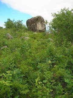


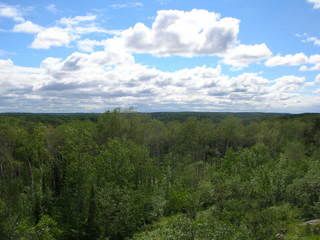
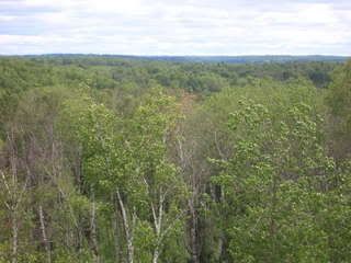
It was the highest point in the area. A cairn-builder had erected steps up to the climbable edges of the boulder, and I climbed up. Standing on top, I could see over the entire valley. The view was incredible.

Views from the boulder:


Then my dad took a turn up top.


When the bottle was filled with berries, I stowed it in my backpack. We could find no trail continuing on from the hillside, so we made our way back to camp.

That night we ate spaghetti dinner. As he had every other night that week, my dad took one last beer into the tent with him. There he read short stories by flashlight, and I would invariably find him asleep with his eyeglasses on his chest.

(28 June)
In the morning, we ate breakfast, struck camp, and said goodbye to Echo Lake.

A few hours down the road, in Hibbing, we went to SuperOne Foods again to get more of that ARCO coffee. While I waited for my dad to exit the bathroom, I overheard a checkout girl say she was going camping that weekend, at Echo Lake! Was this a crazy coincidence, or was it really that popular? It is an exquisite place to camp.

We got to the coffee aisle, and the entire ARCO display was gone! Not a trace remained. It must have been so cheap because they were discontinuing it. ARCO's new packaging had its own spot, and was regular coffee price. Shucks! We bought some snacks and hit the road.

Later, I directed us to the Aitkin County park with the aquifer. My dad was really into these side adventures, and said that he learns so much when we are together. The same is true for me. This had been the best father-son camping trip I'd ever experienced. It was different than any other because I was grown up. My dad had taught me most of what I know about camping, but on this trip, because he was really on vacation from his grueling academic duties, I naturally assumed leadership much of the time. The roles I knew from childhood were reversed. Maybe he was testing me.
Monday, October 22, 2007

18. Real American Heroes

(26 June, continued)

Back at Echo Lake we once again embarked on a paddling adventure. Our goal was to find where Pickett Creek entered the lake, and to see if it was traversable. My dad had passed it on his jog, where it flowed out of a bog that was a designated grouse and woodcock management area.

The wind blew from the west, at our backs, as we paddled east from the dock, I at the bow. We knew the trip back would be brutal. Echo Lake was a lot bigger than either of us had thought. It wasn't too wide, but looked to be at least three miles long, east to west.

After paddling a short while, and after a few rests where my dad cast in his line, we found a little bay, hatched on the edges with the vertical green lines of reed beds. The bay was surrounded by beautiful woods, birch to the east, and pines to the west. A huge white pine stood alone on a small peninsula at the mouth of the bay, guarding its treasures. Sheltered here from the wind, the flies found us, and I soon incited our return to choppy water.

We paddled leisurely south, toward the inside of the bay, into which the creek seemed to be flowing. I scouted ahead for rocks just below the water's surface. Soon we could see Pickett Creek, gurgling over rapids and a little waterfall into Echo Lake. It was picturesque.


The west side of the bay was bordered by rows of straight, slender birch. We watched as a huge heron flew up and behind the outermost row of birch, and then flew slowly along the shoreline, just behind the treetops, with the sun shining at us through the yellow-green leaves.

Magnificent.

We could not go in any further due to rocks. I asked my dad if he was going to fish, and he said that we had better head back, because it was going to take a long time. We made our way back to the main body of Echo Lake, the water choppy like the sea, as a steady gale ripped across its entire east-west length. We dug in and paddled our boat straight into the stream of wind and water. My left shoulder was too sore for this. I asked my dad if I could switch sides, and he said I could paddle on any side I wanted. So I switched, and comfortably paddled on the starboard side the whole way back.

As we battled the elements in our vessel of ancient design and modern materials, I saw now how quickly we had gotten down here, pushed by the wind as we had been. Now we fought against it, the wind and the evening sun in our faces. The boat rocked with the waves. Progress was steady and slow, the wind unrelenting. I gritted my teeth, set my resolve, and locked my gaze at a point of land half a mile ahead, which blocked our destination from view. Again, anger helped pump adrenaline through my straining muscles. I was Rambo. My eyes were set with grim determination beneath my furrowed brow, my jaw in a scowl.

"This is for you guys," I repeated in my mind. This was 'Nam. It was up to us to set the POWs free. My suffering at the helm of this canoe was nothing compared to the tortures inflicted on my comrades. "This is for you guys."

We slowly approached a couple leisurely fishing in a drifting motorboat. As we struggled past, their gazes followed us, and they surely thought we were nuts.

I then used a cycling technique with my paddling, to make sure I didn't burn out before we achieved victory. I noticed that my natural paddling technique was similar to my peddling technique, most likely due to my elongated frame: I ride a big gear. I paddle with long, deep strokes. This is a recipe for power, but also for early burnout. So I increased my paddling cadence, instead using shorter, more shallow strokes, but more of them, faster. It seemed to do the trick. "This is for you guys." I paddled in a frenzy.

It took probably three times longer for us to return than it had going out. We beached, strapped the canoe onto the car, and had a Red Dog down by the boat launch, before returning to camp. For dinner, we ate refried beans, boiled potatoes, and yams.

At sunset, my dad stood next to the car with its canoe helmet, silhouetted against the chrome-colored lake. That sixteen-foot Alumacraft canoe had been in the Stoltz family since 1961, but it was the second. The preceeding canoe had been left in Brownie Lake overnight by my young aunt Maxine, and it had been stolen. She told their folks that she had only left it for a few minutes. Her older brother, my dad, kept her secret.

My mind reeled to imagine all the bodies of water our canoe had traversed over the years. The dull scratches of countless logs, rocks, and beaches covered its hull, as did all the old registration stickers. With a beer in my hand, I stood in awe and reverence. This canoe had never let us down.

The aluminum canoe is such a potent symbol of Europeans in America. The shape is purely Native American in design, adopted by the French-Canadian voyageurs, and crafted, at that time, out of the traditional materials: birchbark, roots, and gum. Aluminum canoes are made from metal mined from the earth by massive, destructive industry. The newer fiberglass ones are created with sophisticated chemistry and engineering, melting sand into glass, and weaving it into powerful strands. But the design remains as it has for thousands of years. Elegant and simple. A silhouette of the past.

Later, my dad and I walked out to the road where the fireflies wandered the night air. "You know what I'm thankful for," he said with earnest, "is that we don't have Tyrannosaurus rex running around. I'm scared enough of bears. But to have those bastards running around, eating people." He shook his head bitterly. "They don't care. They don't care about what you're doing."

Anachronistic Photos, Catalogued

The publishers can only afford one signature of color photos; you know how it is.

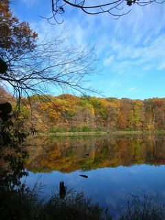
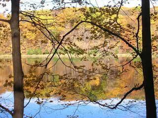
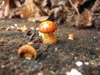
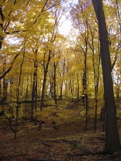
The following photos were taken on Saturday, 20 October, 2007, in Wood-Rill Scientific & Natural Area in Orono. So, chronologically, they don't go with the story. However, that old-growth maple forest is gorgeous right now, and you should get out there. Read about it in one of my previous entries, which gives bike directions at the end. In a car, from Minneapolis, take 394 west, which turns into Hwy 12, and then take a right on Old Long Lake Road. Careful, it comes up quick after a blind turn. Then go about a quarter mile, and you'll see the sign for the parking lot, which will be on the right.


Taken by Ellie Ramson.


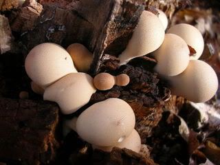
This tiny little guy had a bright orange belly!


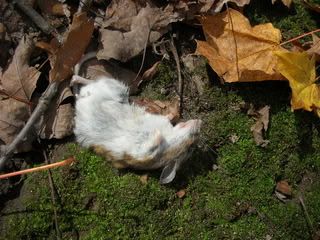
Don't worry; he's just sleeping. For eternity.


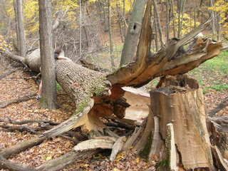
Wicked blowdown. The harder outer bark broke in a perfect zigzag. That's my sister.

Thursday, October 18, 2007

17. Riders on the Storm

(26 June)
On Tuesday, the wind continued to blow, the sky was grey, and my shoulders were sore from paddling. Regardless, after breakfast, my dad and I launched the canoe into Echo Lake. We had only paddled about 100 feet when we felt raindrops and saw lightning in the west. A motorboat was heading back to the dock we had just left. I turned to my dad and said, "Are we stupid...?"

He let out a small laugh and said, "Maybe so," and we returned sheepishly to the dock. In the increasingly heavy rain, we chained and locked the canoe upside-down to a tree, and then got back in the car. We decided to drive up to Crane Lake. My dad told me that it was once a really popular resort area, and his parents had vacationed there as newlyweds.

From this, and my experiences the past week, it seemed apparent that the North Woods, in its pristine beauty, had once been a major gem of national tourism. Its current state, with the faded handcrafted signs, and their masterly aesthetics that stand out in a world of ever more mindless and soulless computer-generated design, added a whole new patina of beauty to my eyes.

As we drove through the rain, I endeavored to choose some music. "I wish we had the Doors' song 'Riders on the Storm'," I said.

"Look in the glove compartment."

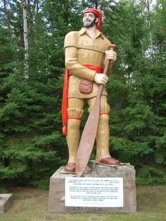
There it was, The Doors, backed with L.A. Woman. Sweet. I put the tape in the deck, and whatta-you-know, it was nearly queued to that song already. There could not have been a more perfect song for us two men in that place at that time. The whisper tracks form a mist around Jim's words. Afterwards, the tape continued onto the Doors' first album, which fit with the weather as well. We passed a giant statue of a voyageur.

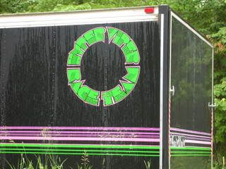
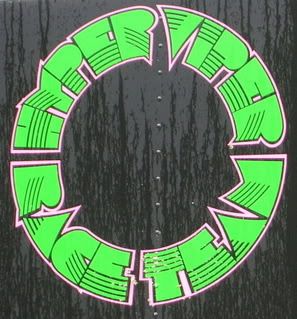
Crane Lake sits on the border of Voyageurs National Park. I never really think much about the fact that Minnesota has a National Park, and I have yet to explore it. The township of Crane Lake is but a handful of cabin resorts, and in the midst of them, St. Louis County Road 24 abruptly ends. Beyond that lies only shabby dirt roads and gravel-surfaced private drives. We tried one road for about a minute before turning around. We slowed down at one point so I could take a photo of a dirt bike trailer with some killer graphics that read, "Hyper Viper Race Team."


We headed out of town the way we came, my dad pointing out the cabin-boats my grandparents had rented. That would sure be a nice vacation for a couple of newlyweds.

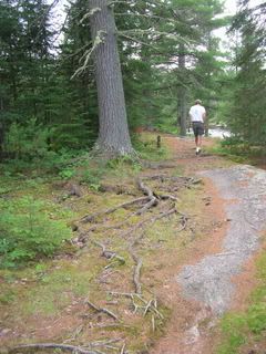
A couple miles south of Crane Lake, we saw a sign for Vermilion Falls, and we decided to check it out. Was it a town or a natural landform? It turned out to be a Superior National Forest recreation area. We parked in the empty lot, and exited the car into sunshine. My dad took his fishing gear, and I took my camera. The trail was rocky and beautifully uneven, with roots of big white pines snaking over the rocks.


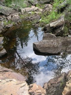
We could hear a waterfall, and soon came upon one zigzagging through a jagged gorge of dark granite. It was like a miniature Jay Cooke State Park. Between the trail and the falls were sublime crevices and pools surrounded by little pines growing from the rocks.


My dad began to fish, and I explored the small but densely beautiful site. I told him I was going back to the car to grab my drawing tablet, and he bade me fetch his eyeglasses. As I searched for them, a car pulled in, and a family set out to hike. I brought my dad his glasses, and then I found a hidden spot in the rocks, where I sat in the sunshine shooting photographs.


The beauty surrounding me kept me shooting for quite a while. I was excited to sketch. I found a couple of twigs to use as pens, and I placed them in a crevice near where I was sitting. I decided I could shoot some video of the falls at the same time, so I got up and began walking back to get my camcorder and tripod. I took my backpack with me. As I approached the parking lot, I saw my dad passing by up ahead. I called out to him, and he stopped.

When I neared, he told me he was done fishing and wanted to return to Echo Lake. I told him my plans, which had hinged on the assumption that he'd be fishing a while. Since he wasn't, I immediately said it was fine, I'd done enough, and we could go. I only wanted to sit and draw a while if he was occupied too. So we took off.

Moments after passing the voyageur statue again, my dad stopped the car, and turned around to take a closer look.


The voyageur had a big, creepy grin, and the text below him read (sic):
This memorial was erected by the Crane Lake Commercial Club to commemorate the FRENCH CANADIAN VOYAGEURS who explored and opened this country beginning in the late 1600's.

Thousands of these dauntless men rowed their birch bark canoes through these waterways in the quest of furs and the Northwest Passage. One of their forts was at the mouth of the Vermillion River in Crane Lake.

The gay garb of these happy courageous men is typified by our memorial as he stands here proudly surveying the lands and waterways he once roamed.

HOME OF THE VOYAGEUR

"The gay garb of these happy courageous men!"

The other interpretive signs were just as poorly written. One began by stating that the landforms of the area "predate" the Native Americans. Yeesh. Really?

...to be continued...

Thursday, October 11, 2007

A Guide to Minnesota's Scientific & Natural Areas

Book Review

A Guide to Minnesota's Scientific and Natural Areas, by the Minnesota Dept. of Natural Resources, 1999.

I found this book invaluable on my explorations of SNAs this summer. It is not only a guidebook, but an advanced course in Minnesota's biomes and geology. The book is divided into three sections, corresponding with the three major biomes, and each of the many ecological subsections are described in academic detail. I would recommend it to both novice and master naturalists. Whether your focus in exploring SNAs is on flora, fauna, geology, or ecosystems in general, this book has the information you need. Reading it will also give you an understanding of the state's geological history. What WAS here, and what is here now.

The book gives directions to all the SNAs, using the nearest towns as reference points, and does so using mileage. For instance, "go one mile down this road, two miles down that road," etc. I drove past sites many times because of this, since a mile is nothing in a car going down the highway after driving hundreds. I suspect that some of these distances refer to the border of the site, rather than to access points and parking areas. Therein lies a minor problem, which could be updated in a revised edition.

One disappointing experience with this came when exploring the Gneiss Outcrops SNA. It is a fairly large prairie site with no trails. I had read Worlds Within a World: Reflections on Minnesota Scientific and Natural Area Preserves by Paul Gruchow, who described an amazing lake in this SNA. After hours of exploring, I never found it. Nevertheless, Gneiss Outcrops is an enchanting place, and well worthwhile. The Guide needs better directions for within sites, especially when there are no trails. Those included in the current edition can be vague.

Part of the adventure in exploring these areas is that entrances and trails may not exist. If you wear boots, and can identify poison ivy, you'll be fine.

As mentioned in my previous post, the map of Pelican Lake was horribly vague. It mentions that Big Island is only accessible by boat, but when actually traversing the water, it would be nice to have an accurate map showing all the islands. There were dozens, and it only shows two!

The Guide is bound with a plastic spiral, a la Kinko's, which seems cheap, but is extremely handy for field use. The pages are thick cardstock. My biggest criticism is that the cover is made from the same stock (something durable and waterproof would be great), with this annoying extra "flap" that's connected to the back cover, and folds over the whole outside of the book. I attempted to fold it inside, and it ended up sticking out half an inch beyond all the other pages. I should have cut it off, knowing now that I'd never use that outer cover again. Design issues.

Included in the book is a seperate fold-out map of the state, showing all the SNAs, which fits in a pocket in the back. This was indespensible in planning my project, where I visited several SNAs on each trip, and had to chart which campgrounds were nearby.

All in all, the book is essential, but could be made much more useful with additional field research and an updated edition. Hey, if the DNR wants to pay me a couple years' salary, I'll do it!

Monday, October 8, 2007

16. Battle for Big Island

(Monday, 25 June)
We woke up, my dad jogged, he bathed in Echo Lake, we ate breakfast, and then we headed out for the critical adventure of our trip: canoeing to Big Island Scientific & Natural Area in Pelican Lake. According to my guidebook,
"Big Island has escaped significant disturbance by fire or humans for over 150 years. As a result, here one can see a collection of old-growth communities, including hardwood-conifer forest and aspen-birch forest, that seldom attain old-growth status... [Also,] at least 40 bird species are summer residents on the island."
Judging by the map, the island lay about two miles over water from the nearest boat launch.

We picked up ice and more coffee in Orr. The ice bag depicted a man in front of an igloo, apparently urinating ice cubes, grimacing, and thinking, "ICE..." Inside the gas station/grocery/video store was also an A&W restaurant, and I saw the girl behind the counter pouring root beer from a two-liter bottle. Don't they have kegs of that stuff?

Orr sits on a bay on the east side of Pelican Lake, which is about eight miles across. The closest boat launch to Big Island was on the west side of the lake, so we drove over there, past the Vince Shute wildlife sanctuary. This launch was really rustic, pretty much just a big rock going into the water. The sun shone bright overhead, and cumulus clouds raced across the sky. The temperature was in the nineties. A strong wind blew from the south, and the water looked really choppy. But we were men. We had a mission. And we were going for it.

We loaded up the canoe, my dad with his fishing gear, and I with my art supplies. I climbed into the bow, and my dad launched the vessel, past a family bobbing in a speedboat, who might have thought we were crazy for challenging the elements in a canoe. As we paddled into the wind, we found we were trucking along pretty swiftly. Canoeing into the wind is far easier than going perpendicular to it, and we maneuvered in this way, trying to stay sheltered within the lee of the islands.

My map had shown only two other little islands besides Big Island, but in reality there were at least a dozen, and we could not differentiate our destination from these until we had cleared several of them. A couple had cabins on them, and one little one was an SNA. Pelican Lake is aptly named, not because it's shaped like a pelican, but because it harbors squadrons of the huge birds. Big Island became apparent as we approached. It is about a mile wide, with a bay on the western side.

We drifted near the island's shore. I ate a sandwich while my dad cast a few lines into the clear, shallow bay. We traced the shore for a while, looking for a trailhead, but we saw none. We docked at a large rock face. My dad said he'd hike with me for a bit, and then he'd go fishing while I explored. It immediately became apparent that there was no trail here, and the thick brush made for more of an adventure than my dad was looking for, so he left me to continue on my own. It was 2:00 pm, and I said I'd meet him back here (at the southwest side) at 5:00. I turned around and headed into the bush.

I never did find any man-made trails. I made my way through the thick undergrowth by following game trails and paths cleared by massive blown-down old trees. I cut a path directly across the island, heading northeast. It was a pretty strenuous hike, constantly pushing through undergrowth and scouting out the path of least obstruction. I was constantly brushing spiderwebs off my sweaty skin. My light cotton long-sleeve and wide-brimmed leather hat helped quite a bit. I grabbed a cudgel to fend off wild beasts, and it also served to push aside branches and webs ahead of me.

Rocky outcroppings and blow-downs offered respite from the trail-blazing, and at these places I stopped to check my compass. Every time I did, I found my sense of direction intact. I had never hiked in such a forest before, one so thick, and with no trails. I really felt like I could have been the first human to tread there, and that was a sublime feeling. I knew the adventure would keep me occupied today, and that I would not be sitting and drawing.

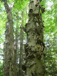
As the book said, a tamarack swamp formed a waist-line across the island. I saw old-growth white pines, none quite as big as in the Lost Forty, but I saw the gnarliest old birch tree I'd ever seen. Its bark curled off in massive rolls all the way up.


An osprey became perturbed at my presence, and circled above me, over treetops at the edge of a clearing, squawking with annoyance, until I disappeared completely.

In an hour's time I reached the northeast side of the island. I found a shady grove of cedars on the bank, and I sat there on a log over the water, feeling the breeze for a while. I then headed back into the bush. I fancied seeing the southeast side of the island, so I started following the shore. This immediately proved difficult, so I turned inland, not straying too far from my previous path.

Big Island is scattered with little groves of mossy rocks and cedars, stands of hardwoods, huge aspen and birch, and tamarack in the lowlands. Most of the pines are on the western side, but are found throughout the island as well. The western side has the highest elevation. From there, a series of high, rocky outcroppings periodically step lower and lower as one travels eastward.

I found myself at the easternmost of these outcroppings, a southeast-facing rock face scattered with cedars and small, spindly trees bearing blueberry-like fruits. I was certain these were a species of blueberry, although the plants were much taller, and the berries were a shade more purple. June berries? I picked one and squeezed some juice upon my finger. It was reddish, like blueberry jam is when spread across a slice of bread. I smelled of it and took a lick of the juice. It tasted sweet, so I ate it. They were certainly edible, delicious in fact, although slightly more tart than blueberries. I ate quite a few.

I stood quietly, not feeling safe enough to sit and expose my head to cougars. I ate berries, and felt the sun's warmth, tempered by a sweet breeze. I thought it an opportune time to do some birding, so I stayed put for a while, before I'd have to begin the hour-long hike back. I saw a pair of downy woodpeckers, and a pair of black & white warblers. I heard many more birds than I could see.

I soon left this idyllic little clearing and made my way back to my father. I almost walked past our rendezvous point, for I was separated from it by an impenetrable thicket, when my dad heard me and called out. I bade him to keep talking, and I followed the voice to the man. He had caught and released a couple bass, a crappie, a northern, and a pan fish or two. What a day of adventure and diversity for both of us!

I was extremely hot and sweaty. I obeyed my urge to to take off my clothes, put on my trunks, and jump into Pelican Lake. It felt great. I wore only shorts, lifejacket, flipflops, and sunglasses on the paddle back. The sun shone in our faces from between blowing clouds on this perfect day.

It took longer to paddle back than it had to get to Big Island, more of a sustained effort. My dad steered us more directly this time; as a result, the waves rocked us from the broadside. I used my anger at this unsteadiness to fuel my physical effort. It was by no means a leisurely paddle, but neither was it unenjoyable.

After we landed, my dad cast his cap ashore, and we noticed that it lay in poison ivy. Regretful. But he managed to get it back to camp and wash it with no ill effects. We strapped our vessel to the car, sat down, and enjoyed an ice-cold Red Dog in the late afternoon sun on Pelican Lake. It was my first one. Not bad at all.

When we got back to camp, my dad looked into our garbage bag of beer cans hanging from a tree.

"What!" he cried with disgust, "Look at this! We drank way more than this. Don't you think?" He looked despondent. "This is terrible." There were at least a dozen cans in there. "I think the host has been pilfering our beer cans."

Wednesday, October 3, 2007

15. Rendezvous des Voyageurs

(24 June)
On Sunday morning at about 11:00, as I consolidated my gear, my dad pulled up in his maroon Chevy Corsica with the old canoe on top. His earliness surprised me. It was great to see him, and we were both excited for our trip. It took a while to get all of our stuff into the car, and we ended up having to ditch Jean-Paul's culligan bottle. Regretful. But there was simply no room.

Off we drove, catching up on each others' lives on the way to Hibbing to get some supplies. We rambled along the dead, historic Sunday streets of Hibbing until we finally landed at SuperOne foods. There we bought groceries, most notably ARCO coffee, from Duluth, ground coarse for percolators, on sale for $3 a pound!

Although we didn't need it this time, I noticed that here, and in every small town I'd been in, the supermarket sells Smart Balance vegan butter. Confoundingly, every loaf of bread in mainstream grocery stores contains high-fructose corn syrup. WHY?

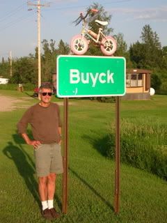
From Hibbing, it really didn't take us long to get up to Orr, home of the giant bluegill, on Pelican Lake in the Superior National Forest. From there we continued up St. Louis County road 23 to Buyck. As we approached, my dad consulted the map and said, "The next town's called 'Boik' or 'Buick' or something like that?" When we saw their road sign, we learned how to pronounce it, for attached to the top of the sign was a little girl's bicycle! "Bike!" The townsfolk must have been sick of hearing it mispronounced.

My Dad.

Our ultimate destination was Echo Lake, down a dirt road seven miles from the Sportsman's Last Chance tavern. The Vermilion River runs through Buyck, and flows north about twelve miles to its terminus in Crane Lake, on the Canadian border.

The campsites at Echo Lake were generously spaced, and we chose one that was pretty open, and overlooked the lake. Several other campsites were occupied, which surprised us, being Sunday night and so remote. There was also a live-in host, which I had never experienced before, camped in a motorhome near the entrance. We saw several trailheads, a dock, a beach, and two playgrounds.

We couldn't believe where we were. It must have been sometime after 3:00 pm. Time for a beer. My dad thought I had asked for MGD instead of High Life, it was ice cold, and it would certainly do. He was saving the Red Dog. We drank MGD and unloaded some gear. In the trunk I saw the Coleman propane stove that had been on every family camping trip I could remember. My dad still kept it in the same cardboard box it came in, and it is a great cardboard box. It's screenprinted with faux woodgrain, to make it look like a crate, and the letters on it appear to be branded onto the "wood." The large photo on the front shows a man with short white hair and a red flannel shirt, squatting on a rocky shore in white canvas shoes, shaking pepper onto his frying eggs with an aluminum shaker. In the background is his beached canoe. What a man!

I noticed two small American flags tucked into the box with the stove. "To keep the rednecks away," my dad said. We clipped one to our site number post, and one to the gable of the tent.

As we sat at the picnic table, my dad said it would be great to bring a birdfeeder camping, to hang up in the site and attract more birds. We had some oranges, so I suggested cutting one in half and impaling the halves on a tree; oranges attract orioles. He liked the idea, and we carried it out.

We then set off in the car (the canoe still on top) with a two-fold mission: to find firewood, and to determine the point five miles from our campsite, where my dad would turn around on his ten-mile run. He had to begin his marathon training in the morning. At the five-mile point there was an easily recognizable grove of birch. I stashed his full bottle of Gatorade at the base of a tree, and dug a line across the road with my boot heel. He couldn't miss it.

On the drive back, we pulled over where we saw some big fallen branches. We went opposite directions. I climbed into a tangled pile of dead tamarack, but the branches were still too green, and only bent instead of breaking. I got back up to the road, and my dad was coming toward the car from the other side. When we met he handed me a tiny wild strawberry! I ate it, and followed him back up the sandy trail where he had come from. There were strawberries growing all over the place! I picked a handful, blew off the fine sand, and ate them with delight. The place he led me was the sad remnant of a clear-cutting job, now an vast dump of dry downed trees. We carried armloads of wood back to the car, and laid it on top of the trunk, underneath the canoe. We made it back to camp with nary a stick lost.

The northern evening granted us beer, roasted root vegetables, and well-earned sleep among the fireflies.